A town shaped by trade
According to UNESCO's World Heritage listing, Utub (Bani Utbah) merchants who migrated from Kuwait established Zubarah in the mid-18th century. Its commercial peak lasted about 50 years, spanning the late 18th and early 19th centuries, when it ranked among the Persian Gulf's most important centers for pearling and trade.
Estimates place its maximum population at between 6,000 and 9,000. The archaeological site extends over roughly 400 hectares, including about 60 hectares within the outer town wall. Wikipedia describes it as Qatar's most substantial archaeological site.
Zubarah is approximately 105 km (65 mi) from Doha, at coordinates 25.9834° N, 51.0272° E.
Defenses and the freshwater supply
A wall built in the late 18th century curved for 2.5 km (1.6 mi) between two points on the shore. Along its length, 22 semicircular towers provided defenses at regular intervals.
The settlement's freshwater wells had their own protection. Qal'at Murair, also called Murair Fort, was built by 1768 about 1.65 km east of town to guard them. An artificial canal linked the fort with the sea, running roughly 1.76 km in length and about 20 m in width.
The abandoned town and the later fort
UNESCO dates the destruction of most of Al Zubarah to 1811, though the town was not finally abandoned until the early 20th century. The stone-and-mortar structures left behind collapsed, and windblown desert sand gradually buried the remains. That covering helped preserve the town's layout.
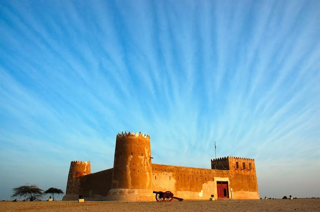
The site's most prominent standing building, Al Zubara Fort, belongs to a later period. Built in 1938, it housed Qatari military and police personnel tasked with protecting the northwest coast. Restoration followed in 1987, and the fort was later converted into a visitor center and museum.
Sovereignty and heritage recognition
Qatar and Bahrain disputed sovereignty over Zubarah until the International Court of Justice ruled in Qatar's favor in 2001.
Al Zubarah Archaeological Site is also a core zone of the Al Reem Biosphere Reserve. In 2007, Al Reem became Qatar's first UNESCO Biosphere Reserve.
UNESCO added Al Zubarah Archaeological Site to the World Heritage List at its 37th session in 2013. The inscription, reference number 1402, recognizes the site under criteria (iii), (iv) and (v).
Places nearby
Ancient Origins lists Wadi Debayan at 4.9 km (3.0 mi) from Zubarah and Murwab at 14 km (9 mi). Other listed places are Ruwayda, 16 km (10 mi) away; Umm Al Maa, 19 km (12 mi); Jebel Jassassiyeh, 38 km (24 mi); and Dilmun, 55 km (34 mi).